Naganandar Lakes
Hike along Mul Nar from Mariv Sudir to Naganandar Lakes. #Hiking #Nature #River #Lake #Mountain #Forest #Glacier
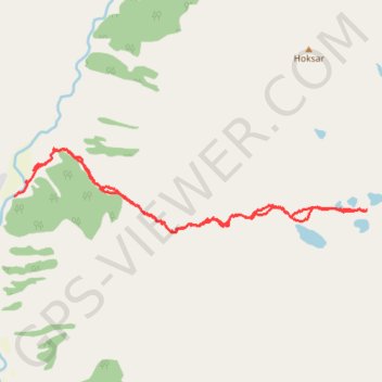
- Distance: 16.8 Km
- Elevation gain: 1,525 m
- Maximum elevation: 4,286 m
- Elevation loss: 1,558 m
- Minimum elevation: 2,771 m
- Moving time: 40 m 19 s
- Moving speed: 25.0 Km/h
- Maximum speed: 35.3 Km/h
- Total time: 40 m 19 s
- Global speed: 25.0 Km/h
Interactive trail map
Trail profile
- Distance: 16.8 Km
- Elevation gain: 1,525 m
- Maximum elevation: 4,286 m
- Elevation loss: 1,558 m
- Minimum elevation: 2,771 m
- Moving time: 40 m 19 s
- Moving speed: 25.0 Km/h
- Maximum speed: 35.3 Km/h
- Total time: 40 m 19 s
- Global speed: 25.0 Km/h
About this trail
Name: Naganandar Lakes trail, distance, elevation, map, profile, GPS track
Start: Sukhnai, Marwah, Kishtwar, Jammu and Kashmir, India (33.98442 75.52117)
End: Rikinwas, Marwah, Kishtwar, Jammu and Kashmir, India (33.98039 75.51757)
Coordinates: 33.97475 75.51757 33.98781 75.58373