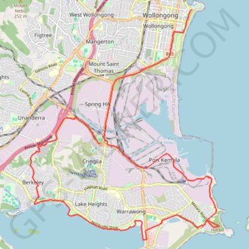
Wollongong Loop
Interactive trail map
Trail profile
- Distance: 28.6 Km
- Elevation gain: 247 m
- Maximum elevation: 58 m
- Elevation loss: 240 m
- Minimum elevation: -1 m
About this trail
Name: Wollongong Loop trail, distance, elevation, map, profile, GPS track
Coordinates: -34.49578 150.84364 -34.42266 150.91663
Topography: Wollongong City Council topographic map, elevation, terrain
Other hiking, mountain biking, running and outdoor activity trails
Click on a trail to view its statistics, map and profile.