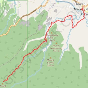
Maragondon - Mount Kalanggaman
- Distance: 28.3 Km
- Elevation gain: 790 m
- Maximum elevation: 559 m
- Elevation loss: 790 m
- Minimum elevation: 12 m
Interactive trail map
Trail profile
- Distance: 28.3 Km
- Elevation gain: 790 m
- Maximum elevation: 559 m
- Elevation loss: 790 m
- Minimum elevation: 12 m
About this trail
Name: Maragondon - Mount Kalanggaman trail, distance, elevation, map, profile, GPS track
Coordinates: 14.21981 120.67398 14.27646 120.73658
Other hiking, mountain biking, running and outdoor activity trails
Click on a trail to view its statistics, map and profile.
Maragondon - Bonifacio Shrine and Eco-Tourism Park
Philippines > Cavite > Maragondon > Caingin
Distance: 11.1 Km • Elevation gain: 113 m • Maximum elevation: 37 m