Fortynine Palms Oasis
Interactive trail map
Trail profile
- Distance: 2.4 Km
- Elevation gain: 124 m
- Maximum elevation: 938 m
- Elevation loss: 100 m
- Minimum elevation: 830 m
About this trail
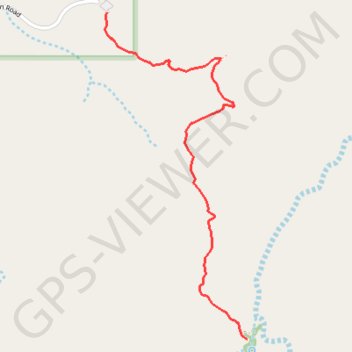
Name: Fortynine Palms Oasis trail, distance, elevation, map, profile, GPS track
Start: Fortynine Palms Trail, San Bernardino County, California, United States (34.11925 -116.11209)
End: Fortynine Palms Trail, San Bernardino County, California, United States (34.10606 -116.10526)
Coordinates: 34.10606 -116.11218 34.11925 -116.10526
Other hiking, mountain biking, running and outdoor activity trails
Click on a trail to view its statistics, map and profile.
Fortynine Palms Oasis in Joshua Tree National Park
United States > California > San Bernardino County
The Fortynine Palms Trail offers a scenic and somewhat strenuous journey into the heart of Joshua Tree National Park. As hikers ascend the ridge, they are treated to panoramic desert views, featuring stark rocky landscapes and vibrant desert flora like barrel cacti, creosote bushes, and the occasional spiny…
Distance: 5.1 Km • Elevation gain: 211 m • Maximum elevation: 939 m