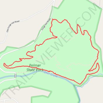
Palmer State Park Loop Trails
- Distance: 5.2 Km
- Elevation gain: 118 m
- Maximum elevation: 140 m
- Elevation loss: 118 m
- Minimum elevation: 48 m
- Moving time: 1 h 23 m
- Moving speed: 3.8 Km/h
- Maximum speed: 6.2 Km/h
- Total time: 1 h 36 m
- Global speed: 3.3 Km/h
Interactive trail map
Trail profile
- Distance: 5.2 Km
- Elevation gain: 118 m
- Maximum elevation: 140 m
- Elevation loss: 118 m
- Minimum elevation: 48 m
- Moving time: 1 h 23 m
- Moving speed: 3.8 Km/h
- Maximum speed: 6.2 Km/h
- Total time: 1 h 36 m
- Global speed: 3.3 Km/h
About this trail
Name: Palmer State Park Loop Trails trail, distance, elevation, map, profile, GPS track
Coordinates: 39.61319 -76.28620 39.62172 -76.27003