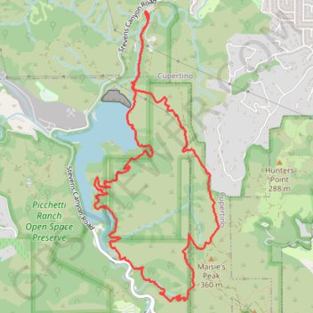
Stevens Canyon Loop via Tony Look Trail, Lookout Trail, and Coyote Ridge Trail
The Stevens Canyon Loop, traversing the Tony Look, Lookout, and Coyote Ridge Trails in Stevens Creek County Park, offers a diverse hiking experience. Hikers can enjoy views of the Stevens Creek Reservoir, rolling hills, oak woodlands, with occasional views of the distant San Jose area. The well-maintained trails provide a mix of shaded woodlands and open ridge vistas, making it a rewarding journey for nature enthusiasts. #Hiking #Forest #Nature #Loop #Lake
- Distance: 10.1 Km
- Elevation gain: 369 m
- Maximum elevation: 308 m
- Elevation loss: 370 m
- Minimum elevation: 125 m
- Moving time: 1 h 52 m
- Moving speed: 5.4 Km/h
- Maximum speed: 15.3 Km/h
- Total time: 2 h 1 m
- Global speed: 5.0 Km/h
Interactive trail map
Trail profile
- Distance: 10.1 Km
- Elevation gain: 369 m
- Maximum elevation: 308 m
- Elevation loss: 370 m
- Minimum elevation: 125 m
- Moving time: 1 h 52 m
- Moving speed: 5.4 Km/h
- Maximum speed: 15.3 Km/h
- Total time: 2 h 1 m
- Global speed: 5.0 Km/h
About this trail
Name: Stevens Canyon Loop via Tony Look Trail, Lookout Trail, and Coyote Ridge Trail trail, distance, elevation, map, profile, GPS track
Coordinates: 37.28066 -122.07937 37.30669 -122.06535