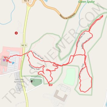
Dittmer-Watts Nature Trail Park loop
- Distance: 4.5 Km
- Elevation gain: 94 m
- Maximum elevation: 354 m
- Elevation loss: 88 m
- Minimum elevation: 329 m
- Moving time: 1 h 16 m
- Moving speed: 3.5 Km/h
- Maximum speed: 39.0 Km/h
- Total time: 1 h 26 m
- Global speed: 3.1 Km/h
Interactive trail map
Trail profile
- Distance: 4.5 Km
- Elevation gain: 94 m
- Maximum elevation: 354 m
- Elevation loss: 88 m
- Minimum elevation: 329 m
- Moving time: 1 h 16 m
- Moving speed: 3.5 Km/h
- Maximum speed: 39.0 Km/h
- Total time: 1 h 26 m
- Global speed: 3.1 Km/h
About this trail
Name: Dittmer-Watts Nature Trail Park loop trail, distance, elevation, map, profile, GPS track
Start: Dogwood Trail, Rutherford County, North Carolina, 28746, United States (35.41131 -82.19616)
Coordinates: 35.40809 -82.19863 35.41484 -82.18801