Nambe Lake - Pecos Wilderness
Wilderness hike
- Distance: 11.3 Km
- Elevation gain: 575 m
- Maximum elevation: 3,475 m
- Elevation loss: 577 m
- Minimum elevation: 3,132 m
- Moving time: 3 h 35 m
- Moving speed: 3.1 Km/h
- Maximum speed: 6.8 Km/h
- Total time: 4 h 18 m
- Global speed: 2.6 Km/h
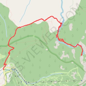
Interactive trail map
Trail profile
- Distance: 11.3 Km
- Elevation gain: 575 m
- Maximum elevation: 3,475 m
- Elevation loss: 577 m
- Minimum elevation: 3,132 m
- Moving time: 3 h 35 m
- Moving speed: 3.1 Km/h
- Maximum speed: 6.8 Km/h
- Total time: 4 h 18 m
- Global speed: 2.6 Km/h
About this trail
Name: Nambe Lake - Pecos Wilderness trail, distance, elevation, map, profile, GPS track
Start: Winsor Trail (Trail 254), Santa Fe County, New Mexico, United States (35.79562 -105.80480)
End: NM 475, Santa Fe County, New Mexico, United States (35.79546 -105.80455)
Coordinates: 35.79546 -105.80485 35.81078 -105.77681
Other hiking, mountain biking, running and outdoor activity trails
Click on a trail to view its statistics, map and profile.
Nambe Lake Trail via Winsor Trail in Santa Fe National Forest
United States > New Mexico > Santa Fe County
The Nambe Lake Trail offers a stunning hike through lush forests and alongside streams, with the grand finale being the pristine Nambe Lake. Starting from the Ski Santa Fe parking area, the hike meanders through a mix of towering aspens and evergreens, with views opening up to the surrounding Sangre de Cristo…
Distance: 10.6 Km • Elevation gain: 554 m • Maximum elevation: 3,473 m
Lake Peak Loop
United States > New Mexico > Santa Fe County
Wilderness hike via Tesuque Creek Trail, Santa Fe Lake, Skyline Trail, Deception Peak, Lake Peak, Penitente Peak, Winsor Trail and Vista Grande Overlook in the Pecos Wilderness. #Hiking #Loop #Nature #Wilderness #Mountain #Forest #Lake
Distance: 27.2 Km • Elevation gain: 1,434 m • Maximum elevation: 3,756 m