Import a GPX file

Settlers Cabin Park Loop

  • Distance: 8.0 Km
  • Elevation gain: 172 m
  • Maximum elevation: 378 m
  • Elevation loss: 174 m
  • Minimum elevation: 278 m
  • Moving time: 1 h 33 m
  • Moving speed: 5.1 Km/h
  • Maximum speed: 10.1 Km/h
  • Total time: 1 h 33 m
  • Global speed: 5.1 Km/h

Interactive trail map

Trail profile

  • Distance: 8.0 Km
  • Elevation gain: 172 m
  • Maximum elevation: 378 m
  • Elevation loss: 174 m
  • Minimum elevation: 278 m
  • Moving time: 1 h 33 m
  • Moving speed: 5.1 Km/h
  • Maximum speed: 10.1 Km/h
  • Total time: 1 h 33 m
  • Global speed: 5.1 Km/h

About this trail
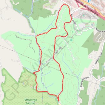
Name: Settlers Cabin Park Loop trail, distance, elevation, map, profile, GPS track

Start: Red Trail, Robinson Township, Allegheny County, Pennsylvania, 15244, United States (40.43524 -80.15759)

End: Red Trail, Robinson Township, Allegheny County, Pennsylvania, 15244, United States (40.43507 -80.15748)

Coordinates: 40.41341 -80.17082 40.43938 -80.15748

Gear up for your next adventure:

🧊Insulated Stainless Steel Flasks - Keep water cold for 24 hours in the heat or coffee hot in the cold
👖Convertible Hiking Trousers - Zip-off legs to adapt to changing temperatures throughout the day
🦟Insect Repellent - Protection against insects
🚴Bike GPS - GPS devices for cycling
🦯Adjustable Trekking Poles - Reduce impact on knees when descending steep topographic ridges

As an Amazon Associate, this site earns from qualifying purchases at no extra cost to you.