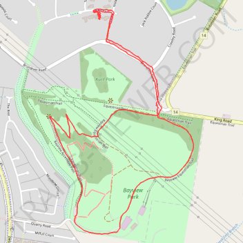
Bayview Park Loop Walk
- Distance: 4.4 Km
- Elevation gain: 130 m
- Maximum elevation: 164 m
- Elevation loss: 129 m
- Minimum elevation: 98 m
- Moving time: 59 m 43 s
- Moving speed: 4.4 Km/h
- Maximum speed: 6.6 Km/h
- Total time: 1 h 23 s
- Global speed: 4.4 Km/h
Interactive trail map
Trail profile
- Distance: 4.4 Km
- Elevation gain: 130 m
- Maximum elevation: 164 m
- Elevation loss: 129 m
- Minimum elevation: 98 m
- Moving time: 59 m 43 s
- Moving speed: 4.4 Km/h
- Maximum speed: 6.6 Km/h
- Total time: 1 h 23 s
- Global speed: 4.4 Km/h
About this trail
Name: Bayview Park Loop Walk trail, distance, elevation, map, profile, GPS track
Coordinates: -38.00474 145.32500 -37.99444 145.33335
Topography: Melbourne topographic map, elevation, terrain