
Acacia Park Loop
- Distance: 5.5 Km
- Elevation gain: 36 m
- Maximum elevation: 333 m
- Elevation loss: 31 m
- Minimum elevation: 318 m
- Moving time: 25 m 35 s
- Moving speed: 12.9 Km/h
- Maximum speed: 17.4 Km/h
- Total time: 25 m 35 s
- Global speed: 12.9 Km/h
Interactive trail map
Trail profile
- Distance: 5.5 Km
- Elevation gain: 36 m
- Maximum elevation: 333 m
- Elevation loss: 31 m
- Minimum elevation: 318 m
- Moving time: 25 m 35 s
- Moving speed: 12.9 Km/h
- Maximum speed: 17.4 Km/h
- Total time: 25 m 35 s
- Global speed: 12.9 Km/h
About this trail
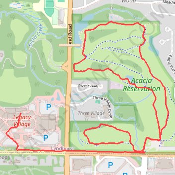
Name: Acacia Park Loop trail, distance, elevation, map, profile, GPS track
Start: Headwaters Loop, Lyndhurst, Cuyahoga County, Ohio, 44124, United States (41.50198 -81.49271)
End: 24665, Cedar Road, Lyndhurst, Cuyahoga County, Ohio, 44124, United States (41.50391 -81.50184)
Coordinates: 41.50128 -81.50313 41.51003 -81.48870