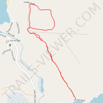
Zophar Willard Trail
- Distance: 2.6 Km
- Elevation gain: 64 m
- Maximum elevation: 430 m
- Elevation loss: 66 m
- Minimum elevation: 367 m
- Moving time: 39 m 36 s
- Moving speed: 3.9 Km/h
- Maximum speed: 6.6 Km/h
- Total time: 43 m 36 s
- Global speed: 3.6 Km/h
Interactive trail map
Trail profile
- Distance: 2.6 Km
- Elevation gain: 64 m
- Maximum elevation: 430 m
- Elevation loss: 66 m
- Minimum elevation: 367 m
- Moving time: 39 m 36 s
- Moving speed: 3.9 Km/h
- Maximum speed: 6.6 Km/h
- Total time: 43 m 36 s
- Global speed: 3.6 Km/h
About this trail
Name: Zophar Willard Trail trail, distance, elevation, map, profile, GPS track
Coordinates: 42.93998 -72.09208 42.94804 -72.08652