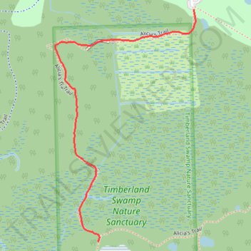
Trail in Timberland Nature Sanctuary in Springfield Township, MI
- Distance: 1.1 Km
- Elevation gain: 9 m
- Maximum elevation: 314 m
- Elevation loss: 7 m
- Minimum elevation: 307 m
- Moving time: 23 m 36 s
- Moving speed: 2.9 Km/h
- Maximum speed: 14.7 Km/h
- Total time: 30 m 20 s
- Global speed: 2.3 Km/h
Interactive trail map
Trail profile
- Distance: 1.1 Km
- Elevation gain: 9 m
- Maximum elevation: 314 m
- Elevation loss: 7 m
- Minimum elevation: 307 m
- Moving time: 23 m 36 s
- Moving speed: 2.9 Km/h
- Maximum speed: 14.7 Km/h
- Total time: 30 m 20 s
- Global speed: 2.3 Km/h
About this trail
Name: Trail in Timberland Nature Sanctuary in Springfield Township, MI trail, distance, elevation, map, profile, GPS track
Coordinates: 42.71712 -83.49635 42.72317 -83.49138