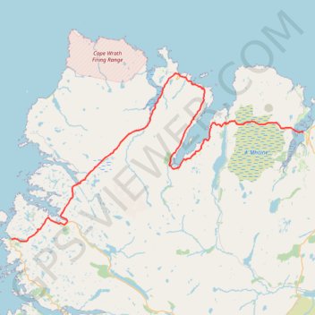
North West Highlands Geopark
- Distance: 86.3 Km
- Elevation gain: 1,184 m
- Maximum elevation: 227 m
- Elevation loss: 1,189 m
- Minimum elevation: 0 m
- Moving time: 6 h 17 m
- Moving speed: 13.7 Km/h
- Maximum speed: 54.5 Km/h
- Total time: 8 h 2 m
- Global speed: 10.7 Km/h
Interactive trail map
Trail profile
- Distance: 86.3 Km
- Elevation gain: 1,184 m
- Maximum elevation: 227 m
- Elevation loss: 1,189 m
- Minimum elevation: 0 m
- Moving time: 6 h 17 m
- Moving speed: 13.7 Km/h
- Maximum speed: 54.5 Km/h
- Total time: 8 h 2 m
- Global speed: 10.7 Km/h
About this trail
Name: North West Highlands Geopark trail, distance, elevation, map, profile, GPS track
End: A838, Tongue, Highland, Scotland, IV27 4XH, United Kingdom (58.49200 -4.42731)
Coordinates: 58.34857 -5.15629 58.56865 -4.42731