Import a GPX file

South Coast Track - Rocky Bay - South Cape Bay

South West National Park. #Hiking #SouthWest #Tasmania

  • Distance: 16.8 Km
  • Elevation gain: 286 m
  • Maximum elevation: 44 m
  • Elevation loss: 289 m
  • Minimum elevation: -1 m
  • Moving time: 4 h 31 m
  • Moving speed: 3.7 Km/h
  • Maximum speed: 18.7 Km/h
  • Total time: 5 h 25 m
  • Global speed: 3.1 Km/h

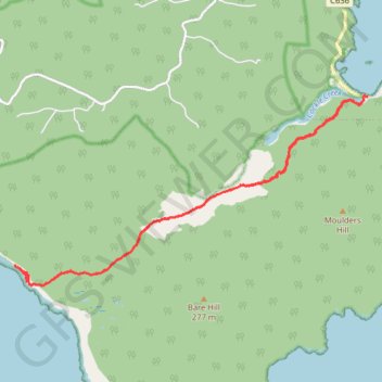
Interactive trail map

Trail profile

  • Distance: 16.8 Km
  • Elevation gain: 286 m
  • Maximum elevation: 44 m
  • Elevation loss: 289 m
  • Minimum elevation: -1 m
  • Moving time: 4 h 31 m
  • Moving speed: 3.7 Km/h
  • Maximum speed: 18.7 Km/h
  • Total time: 5 h 25 m
  • Global speed: 3.1 Km/h

About this trail

Name: South Coast Track - Rocky Bay - South Cape Bay trail, distance, elevation, map, profile, GPS track

Start: South Coast Track, Cockle Creek, Recherche, Huon Valley, Tasmania, 7109, Australia (-43.58377 146.89272)

End: Cockle Creek, Recherche, Huon Valley, Tasmania, 7109, Australia (-43.58278 146.89410)

Coordinates: -43.61135 146.82031 -43.58263 146.89410

Topography: Tasmania topographic map, elevation, terrain

Gear up for your next adventure:

📡Portable Emergency Radios - Stay informed about weather warnings and bushfire alerts
🔑Heavy Duty Carabiners - Secure gear to the outside of your pack for easy access
🛰️Handheld GPS Units - Rugged GPS devices for tracking coordinates and elevation in the Australian bush
📷Backpack Camera Clips - Quick access to your camera while keeping your hands free for climbing
🥾Hiking Boots - Durable hiking boots for trails and rough terrain

As an Amazon Associate, this site earns from qualifying purchases at no extra cost to you.