Import a GPX file

Santa Clarita Central Park loop walk

  • Distance: 1.6 Km
  • Elevation gain: 15 m
  • Maximum elevation: 387 m
  • Elevation loss: 15 m
  • Minimum elevation: 376 m
  • Moving time: 25 m 57 s
  • Moving speed: 3.7 Km/h
  • Maximum speed: 7.2 Km/h
  • Total time: 33 m 14 s
  • Global speed: 2.9 Km/h

Interactive trail map

Trail profile

  • Distance: 1.6 Km
  • Elevation gain: 15 m
  • Maximum elevation: 387 m
  • Elevation loss: 15 m
  • Minimum elevation: 376 m
  • Moving time: 25 m 57 s
  • Moving speed: 3.7 Km/h
  • Maximum speed: 7.2 Km/h
  • Total time: 33 m 14 s
  • Global speed: 2.9 Km/h

About this trail

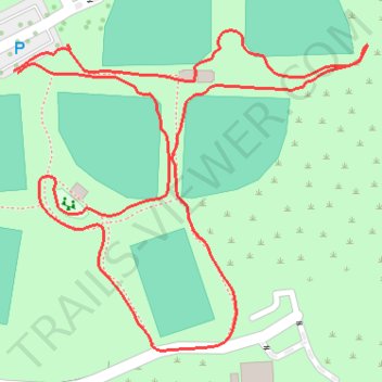
Name: Santa Clarita Central Park loop walk trail, distance, elevation, map, profile, GPS track

Start: Bouquet Canyon Road, Santa Clarita, Los Angeles County, California, 91350, United States (34.43450 -118.52160)

End: Bouquet Canyon Road, Santa Clarita, Los Angeles County, California, 91350, United States (34.43448 -118.52156)

Coordinates: 34.43207 -118.52160 34.43485 -118.51789

Gear up for your next adventure:

Altimeter Barometer Watches - Outdoor watches with built-in sensors to track altitude changes and weather shifts
👖Convertible Hiking Trousers - Zip-off legs to adapt to changing temperatures throughout the day
🪫Rechargeable Headlamps - USB rechargeable headlamps
🧺Waterproof Dry Sacks - Organize your pack and keep electronics safe from rain and river crossings
🧊Insulated Stainless Steel Flasks - Keep water cold for 24 hours in the heat or coffee hot in the cold

As an Amazon Associate, this site earns from qualifying purchases at no extra cost to you.