
Loop walk in McFarland Park
- Distance: 1.5 Km
- Elevation gain: 22 m
- Maximum elevation: 313 m
- Elevation loss: 22 m
- Minimum elevation: 291 m
- Moving time: 20 m 42 s
- Moving speed: 4.4 Km/h
- Maximum speed: 6.7 Km/h
- Total time: 28 m 2 s
- Global speed: 3.2 Km/h
Interactive trail map
Trail profile
- Distance: 1.5 Km
- Elevation gain: 22 m
- Maximum elevation: 313 m
- Elevation loss: 22 m
- Minimum elevation: 291 m
- Moving time: 20 m 42 s
- Moving speed: 4.4 Km/h
- Maximum speed: 6.7 Km/h
- Total time: 28 m 2 s
- Global speed: 3.2 Km/h
About this trail
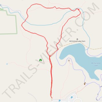
Name: Loop walk in McFarland Park trail, distance, elevation, map, profile, GPS track
Start: 180th Street, Milford Township, Story County, Iowa, United States (42.09280 -93.57278)
End: 180th Street, Milford Township, Story County, Iowa, United States (42.09264 -93.57270)
Coordinates: 42.09264 -93.57473 42.09728 -93.57084