Import a GPX file

La Tuna Canyon Hike trails

Click on a trail to view its statistics, map and profile.
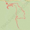
Old La Tuna Canyon hike

United States > California > Los Angeles County > Los Angeles

Distance: 6.3 Km • Elevation gain: 419 m • Maximum elevation: 687 m
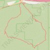
La Tuna Canyon Hike

United States > California > Los Angeles County > Los Angeles

Distance: 4.4 Km • Elevation gain: 369 m • Maximum elevation: 859 m

Gear up for your next adventure:

🦟Heavy Duty Insect Repellent - Essential protection against flies, mozzies, and march flies
🚁Camera Drones with GPS - Capture aerial views of the landscape to compare with topo maps
📡Weather Radios - Emergency weather radios
🧥Packable Rain Jackets - Breathable waterproof layers for unpredictable mountain weather
💧Personal Water Filters - Drink safely from streams and lakes identified on your map

As an Amazon Associate, this site earns from qualifying purchases at no extra cost to you.