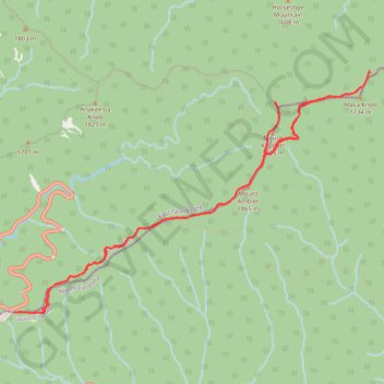
Appalachian Trail : Charlies Bunyon, Mount Kephart and Mount Ambler from Newfound Gap
- Distance: 14.1 Km
- Elevation gain: 747 m
- Maximum elevation: 1,875 m
- Elevation loss: 748 m
- Minimum elevation: 1,535 m
- Moving time: 4 h 12 m
- Moving speed: 3.3 Km/h
- Maximum speed: 5.0 Km/h
- Total time: 4 h 46 m
- Global speed: 3.0 Km/h
Interactive trail map
Trail profile
- Distance: 14.1 Km
- Elevation gain: 747 m
- Maximum elevation: 1,875 m
- Elevation loss: 748 m
- Minimum elevation: 1,535 m
- Moving time: 4 h 12 m
- Moving speed: 3.3 Km/h
- Maximum speed: 5.0 Km/h
- Total time: 4 h 46 m
- Global speed: 3.0 Km/h
About this trail
Name: Appalachian Trail : Charlies Bunyon, Mount Kephart and Mount Ambler from Newfound Gap trail, distance, elevation, map, profile, GPS track
Start: Appalachian Trail, Sevier County, East Tennessee, Tennessee, United States (35.61096 -83.42466)
End: Appalachian Trail, Sevier County, East Tennessee, Tennessee, United States (35.61093 -83.42471)
Coordinates: 35.61081 -83.42471 35.63749 -83.37650
Other hiking, mountain biking, running and outdoor activity trails
Click on a trail to view its statistics, map and profile.
Charlies Bunion via Appalachian Trail from Newfound Gap in Great Smoky Mountains National Park
United States > North Carolina > Swain County
The hike to Charlies Bunion is a rewarding experience characterized by stunning panoramic views of the Great Smoky Mountains. As you traverse the Appalachian Trail, you'll encounter diverse landscapes, including dense forests of Fraser fir and red spruce, as well as several scenic overlooks that reveal…
Distance: 13.3 Km • Elevation gain: 678 m • Maximum elevation: 1,851 m
Great Smoky Mountains Appalachian Trail
United States > North Carolina > Clay County
Hike through Great Smoky Mountains along Appalachian Trail via Standing Indian, Ridgepole Mountain, Yellow Bald, Wine Spring Bald, Copper Ridge Bald, Cheoah Bald, Wauchecha Bald, Fontana Dam, Thunderhead Mountain, Clingmans Dome, Mount Kephart and Mount Guyot. #Hiking #Mountain #Nature #Forest #Lake…
Distance: 231.7 Km • Elevation gain: 8,873 m • Maximum elevation: 2,013 m