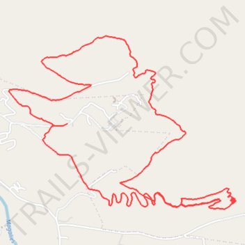
Magaliesberg Mountains Range
- Distance: 10.3 Km
- Elevation gain: 246 m
- Maximum elevation: 1,596 m
- Elevation loss: 255 m
- Minimum elevation: 1,438 m
- Moving time: 2 h 11 m
- Moving speed: 4.7 Km/h
- Maximum speed: 6.8 Km/h
- Total time: 2 h 14 m
- Global speed: 4.6 Km/h
Interactive trail map
Trail profile
- Distance: 10.3 Km
- Elevation gain: 246 m
- Maximum elevation: 1,596 m
- Elevation loss: 255 m
- Minimum elevation: 1,438 m
- Moving time: 2 h 11 m
- Moving speed: 4.7 Km/h
- Maximum speed: 6.8 Km/h
- Total time: 2 h 14 m
- Global speed: 4.6 Km/h
About this trail
Name: Magaliesberg Mountains Range trail, distance, elevation, map, profile, GPS track
Coordinates: -25.98985 27.54605 -25.97673 27.56520