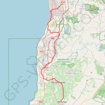
Willunga - Marion
Interactive trail map
Trail profile
- Distance: 47.2 Km
- Elevation gain: 392 m
- Maximum elevation: 147 m
- Elevation loss: 472 m
- Minimum elevation: 2 m
About this trail
Name: Willunga - Marion trail, distance, elevation, map, profile, GPS track
Coordinates: -35.26963 138.48351 -34.99759 138.55963
Topography: Adelaide topographic map, elevation, terrain
Other hiking, mountain biking, running and outdoor activity trails
Click on a trail to view its statistics, map and profile.
Brighton - Adelaide
Australia > South Australia > Adelaide
#Bike
Distance: 23.4 Km • Elevation gain: 101 m • Maximum elevation: 53 m