Falls View Trail
- Distance: 0.6 Km
- Elevation gain: 12 m
- Maximum elevation: 28 m
- Elevation loss: 1 m
- Minimum elevation: 16 m
- Moving time: 12 m 46 s
- Moving speed: 2.9 Km/h
- Maximum speed: 12.4 Km/h
- Total time: 14 m 22 s
- Global speed: 2.6 Km/h
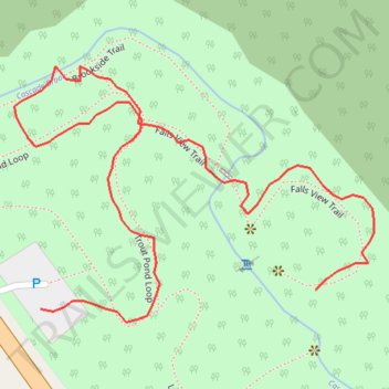
Interactive trail map
Trail profile
- Distance: 0.6 Km
- Elevation gain: 12 m
- Maximum elevation: 28 m
- Elevation loss: 1 m
- Minimum elevation: 16 m
- Moving time: 12 m 46 s
- Moving speed: 2.9 Km/h
- Maximum speed: 12.4 Km/h
- Total time: 14 m 22 s
- Global speed: 2.6 Km/h
About this trail
Name: Falls View Trail trail, distance, elevation, map, profile, GPS track
Start: Falls View Trail, Saco, York County, Maine, 04072, United States (43.54276 -70.40561)
End: Cascade Road, Saco, York County, Maine, 04072, United States (43.54267 -70.40741)
Coordinates: 43.54261 -70.40758 43.54382 -70.40523