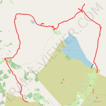
Cycle to Loch à Chait, Craigsheal and Buckinhill
- Distance: 12.9 Km
- Elevation gain: 308 m
- Maximum elevation: 430 m
- Elevation loss: 270 m
- Minimum elevation: 271 m
- Moving time: 2 h 20 m
- Moving speed: 5.5 Km/h
- Maximum speed: 28.8 Km/h
- Total time: 2 h 48 m
- Global speed: 4.6 Km/h
Interactive trail map
Trail profile
- Distance: 12.9 Km
- Elevation gain: 308 m
- Maximum elevation: 430 m
- Elevation loss: 270 m
- Minimum elevation: 271 m
- Moving time: 2 h 20 m
- Moving speed: 5.5 Km/h
- Maximum speed: 28.8 Km/h
- Total time: 2 h 48 m
- Global speed: 4.6 Km/h
About this trail
Name: Cycle to Loch à Chait, Craigsheal and Buckinhill trail, distance, elevation, map, profile, GPS track
Start: Dunkeld Road, Butterstone, Perth and Kinross, Scotland, PH8 0EU, United Kingdom (56.61684 -3.54715)
End: Buckinhill, Perth and Kinross, Scotland, PH10 7PU, United Kingdom (56.62727 -3.50230)
Coordinates: 56.61684 -3.56219 56.65189 -3.49937
Other hiking, mountain biking, running and outdoor activity trails
Click on a trail to view its statistics, map and profile.
Alyth to Spittal of Glenshee - Cateran Trail (some of)
United Kingdom > Scotland > Perth and Kinross > Alyth
Distance: 44.2 Km • Elevation gain: 1,134 m • Maximum elevation: 650 m
Around Loch Ordie
United Kingdom > Scotland > Perth and Kinross
Mountain Bike Ride, UK, Perthshire, Dunkeld
Distance: 35.8 Km • Elevation gain: 579 m • Maximum elevation: 300 m