Dijon
<p>Stadswandeling in Dijon</p>
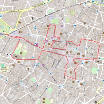
- Distance: 3.6 Km
- Elevation gain: 16 m
- Maximum elevation: 256 m
- Elevation loss: 16 m
- Minimum elevation: 247 m
Interactive trail map
Trail profile
- Distance: 3.6 Km
- Elevation gain: 16 m
- Maximum elevation: 256 m
- Elevation loss: 16 m
- Minimum elevation: 247 m
About this trail
Name: Dijon trail, distance, elevation, map, profile, GPS track
Coordinates: 47.31944 5.03279 47.32436 5.04550
Other hiking, mountain biking, running and outdoor activity trails
Click on a trail to view its statistics, map and profile.
PT23DS2 Lörrach → Cadaqués
Germany > Baden-Württemberg > Landkreis Lörrach > Lörrach (Kernstadt)
Distance: 1,050.7 Km • Elevation gain: 13,130 m • Maximum elevation: 1,505 m