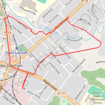
Walk around Essex Junction
- Distance: 4.0 Km
- Elevation gain: 26 m
- Maximum elevation: 112 m
- Elevation loss: 26 m
- Minimum elevation: 101 m
- Moving time: 54 m 49 s
- Moving speed: 4.4 Km/h
- Maximum speed: 33.2 Km/h
- Total time: 57 m 17 s
- Global speed: 4.2 Km/h
Interactive trail map
Trail profile
- Distance: 4.0 Km
- Elevation gain: 26 m
- Maximum elevation: 112 m
- Elevation loss: 26 m
- Minimum elevation: 101 m
- Moving time: 54 m 49 s
- Moving speed: 4.4 Km/h
- Maximum speed: 33.2 Km/h
- Total time: 57 m 17 s
- Global speed: 4.2 Km/h
About this trail
Name: Walk around Essex Junction trail, distance, elevation, map, profile, GPS track
Coordinates: 44.48799 -73.11209 44.49617 -73.09704
Other hiking, mountain biking, running and outdoor activity trails
Click on a trail to view its statistics, map and profile.