Track_AECW_821_2023_11_27_2023_11_27_1701185001391
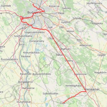
- Distance: 164.5 Km
- Elevation gain: 654 m
- Maximum elevation: 244 m
- Elevation loss: 660 m
- Minimum elevation: 101 m
Interactive trail map
Trail profile
- Distance: 164.5 Km
- Elevation gain: 654 m
- Maximum elevation: 244 m
- Elevation loss: 660 m
- Minimum elevation: 101 m
About this trail
Name: Track_AECW_821_2023_11_27_2023_11_27_1701185001391 trail, distance, elevation, map, profile, GPS track
Coordinates: 46.80155 18.88404 47.56076 19.62722
Other hiking, mountain biking, running and outdoor activity trails
Click on a trail to view its statistics, map and profile.
Privdat1 délután
Distance: 17.4 Km • Elevation gain: 76 m • Maximum elevation: 121 m