Prairie Mountain
Kananaskis Country Public Land Use Zone. #Hiking #Kananaskis
- Distance: 6.6 Km
- Elevation gain: 685 m
- Maximum elevation: 2,195 m
- Elevation loss: 685 m
- Minimum elevation: 1,509 m
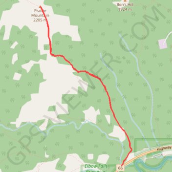
Interactive trail map
Trail profile
- Distance: 6.6 Km
- Elevation gain: 685 m
- Maximum elevation: 2,195 m
- Elevation loss: 685 m
- Minimum elevation: 1,509 m
About this trail
Name: Prairie Mountain trail, distance, elevation, map, profile, GPS track
Start: Prairie Mountain, Kananaskis Improvement District, Alberta, Canada (50.86659 -114.78885)
End: Prairie Mountain, Kananaskis Improvement District, Alberta, Canada (50.86659 -114.78885)
Coordinates: 50.86659 -114.80649 50.88842 -114.78669
Other hiking, mountain biking, running and outdoor activity trails
Click on a trail to view its statistics, map and profile.