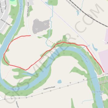
Grand Valley Trail
Grand River. #Hiking
- Distance: 5.9 Km
- Elevation gain: 67 m
- Maximum elevation: 253 m
- Elevation loss: 67 m
- Minimum elevation: 217 m
Interactive trail map
Trail profile
- Distance: 5.9 Km
- Elevation gain: 67 m
- Maximum elevation: 253 m
- Elevation loss: 67 m
- Minimum elevation: 217 m
About this trail
Name: Grand Valley Trail trail, distance, elevation, map, profile, GPS track
Start: SC Johnson Trail, Paris, Brant County, Ontario, N3L 3H3, Canada (43.17485 -80.35162)
End: SC Johnson Trail, Paris, Brant County, Ontario, N3L 3H3, Canada (43.17485 -80.35162)
Coordinates: 43.17485 -80.37293 43.18058 -80.35162