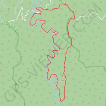
Lerderderg River - Western Plains
#Hiking #Loop #Lerderderg
- Distance: 12.8 Km
- Elevation gain: 445 m
- Maximum elevation: 606 m
- Elevation loss: 446 m
- Minimum elevation: 379 m
Interactive trail map
Trail profile
- Distance: 12.8 Km
- Elevation gain: 445 m
- Maximum elevation: 606 m
- Elevation loss: 446 m
- Minimum elevation: 379 m
About this trail
Name: Lerderderg River - Western Plains trail, distance, elevation, map, profile, GPS track
Coordinates: -37.52630 144.35741 -37.49377 144.37601
Topography: Victoria topographic map, elevation, terrain