Kasha-Katuwe Tent Rocks National Monument via Slot Canyon Trail and Cave Loop Trail
The combination of the Slot Canyon Trail and Cave Loop Trail offers a captivating hike through some of New Mexico's most distinctive landscapes. The Slot Canyon Trail takes you through narrow, winding corridors of rock, where towering walls of smooth tuff reveal the sculptural beauty of hoodoos and the stunning geological formations that gave the monument its name. After emerging from the canyon, the trail leads up to sweeping views of the surrounding valley and distant mountains, providing a perspective of the monument's surreal rock spires from above. The Cave Loop Trail offers a more relaxed, yet equally impressive, journey at the base of these formations, with a close-up view of the "cave" alcove and hoodoos, adding variety to the overall hiking experience. #Hiking #Canyon #Desert #Rock #Nature
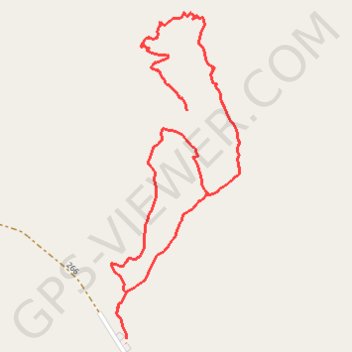
- Distance: 5.5 Km
- Elevation gain: 303 m
- Maximum elevation: 1,931 m
- Elevation loss: 303 m
- Minimum elevation: 1,748 m
Interactive trail map
Trail profile
- Distance: 5.5 Km
- Elevation gain: 303 m
- Maximum elevation: 1,931 m
- Elevation loss: 303 m
- Minimum elevation: 1,748 m
About this trail
Name: Kasha-Katuwe Tent Rocks National Monument via Slot Canyon Trail and Cave Loop Trail trail, distance, elevation, map, profile, GPS track
Start: 266, Sandoval County, New Mexico, United States (35.65670 -106.41100)
End: 266, Sandoval County, New Mexico, United States (35.65665 -106.41100)
Coordinates: 35.65665 -106.41163 35.66810 -106.40608