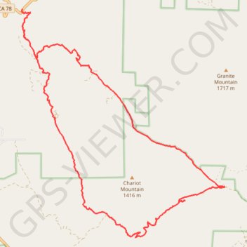
Chariot Mountain Loop via Oriflamme Canyon
- Distance: 26.5 Km
- Elevation gain: 953 m
- Maximum elevation: 1,265 m
- Elevation loss: 952 m
- Minimum elevation: 769 m
- Moving time: 3 h 3 m
- Moving speed: 8.7 Km/h
- Maximum speed: 29.1 Km/h
- Total time: 4 h 10 m
- Global speed: 6.3 Km/h
Interactive trail map
Trail profile
- Distance: 26.5 Km
- Elevation gain: 953 m
- Maximum elevation: 1,265 m
- Elevation loss: 952 m
- Minimum elevation: 769 m
- Moving time: 3 h 3 m
- Moving speed: 8.7 Km/h
- Maximum speed: 29.1 Km/h
- Total time: 4 h 10 m
- Global speed: 6.3 Km/h
About this trail
Name: Chariot Mountain Loop via Oriflamme Canyon trail, distance, elevation, map, profile, GPS track
Coordinates: 33.00426 -116.54772 33.06825 -116.47976