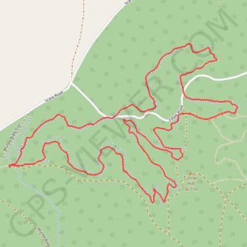
Turner Hill Mountain Bike Trail
Interactive trail map
Trail profile
- Distance: 9.2 Km
- Elevation gain: 190 m
- Maximum elevation: 359 m
- Elevation loss: 190 m
- Minimum elevation: 281 m
About this trail
Name: Turner Hill Mountain Bike Trail trail, distance, elevation, map, profile, GPS track
Coordinates: -32.63905 116.00319 -32.62684 116.02406
Topography: Western Australia topographic map, elevation, terrain