Import a GPX file

Bourgeau Lake

Banff National Park. #Hiking #Bourgeau #Banff

  • Distance: 14.7 Km
  • Elevation gain: 785 m
  • Maximum elevation: 2,134 m
  • Elevation loss: 786 m
  • Minimum elevation: 1,420 m

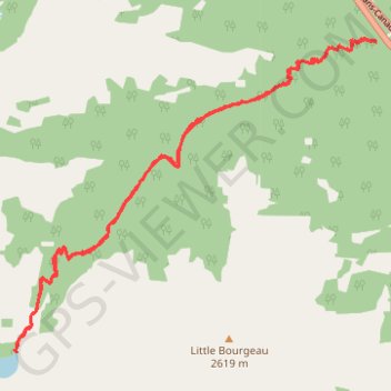
Interactive trail map

Trail profile

  • Distance: 14.7 Km
  • Elevation gain: 785 m
  • Maximum elevation: 2,134 m
  • Elevation loss: 786 m
  • Minimum elevation: 1,420 m

About this trail

Name: Bourgeau Lake trail, distance, elevation, map, profile, GPS track

Start: Harvey Pass Trail Parking, Harvey Pass Tr, Improvement District No. 9, Alberta, Canada (51.16796 -115.73150)

End: Harvey Pass Tr, Improvement District No. 9, Alberta, Canada (51.16814 -115.73163)

Coordinates: 51.13712 -115.78899 51.16839 -115.73150

Gear up for your next adventure:

🛌Sleeping Mats - Insulated mats for camping comfort
🚁Camera Drones with GPS - Capture aerial views of the landscape to compare with topo maps
Outdoor Coffee Makers - Enjoy quality coffee at the summit of your favorite peak
📻Handheld UHF Radios - Critical communication for groups in the Australian outback
📕Hiking Guide Books - Guides for hiking trails

As an Amazon Associate, this site earns from qualifying purchases at no extra cost to you.