
Positano - Santa Maria al Castello - Spiaggia di Fornillo
- Distance: 8.1 Km
- Elevation gain: 963 m
- Maximum elevation: 679 m
- Elevation loss: 960 m
- Minimum elevation: 11 m
Interactive trail map
Trail profile
- Distance: 8.1 Km
- Elevation gain: 963 m
- Maximum elevation: 679 m
- Elevation loss: 960 m
- Minimum elevation: 11 m
About this trail

Name: Positano - Santa Maria al Castello - Spiaggia di Fornillo trail, distance, elevation, map, profile, GPS track
Coordinates: 40.62588 14.47738 40.63915 14.48718
Other hiking, mountain biking, running and outdoor activity trails
Click on a trail to view its statistics, map and profile.
Path of the Gods | Sentiero degli Dei: Bomerano - Positano
Italy > Campania > Naples > Bomerano
Distance: 8.3 Km • Elevation gain: 616 m • Maximum elevation: 652 m
Path of the Gods | Sentiero degli Dei: Bomerano - Positano
Italy > Campania > Naples > Bomerano
https://en-hk.gps-viewer.com/track-lhff3/Path-of-the-Gods-Sentiero-degli-Dei-Bomerano-Positano/
Distance: 8.3 Km • Elevation gain: 620 m • Maximum elevation: 652 m
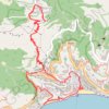
Positano - Santa Maria al Castello - Spiaggia di Fornillo
Italy > Campania > Salerno > Arienzo > Montepertuso
Distance: 8.1 Km • Elevation gain: 963 m • Maximum elevation: 679 m