The Cumby Race Course
Interactive trail map
Trail profile
- Distance: 20.7 Km
- Elevation gain: 615 m
- Maximum elevation: 420 m
- Elevation loss: 611 m
- Minimum elevation: 147 m
About this trail
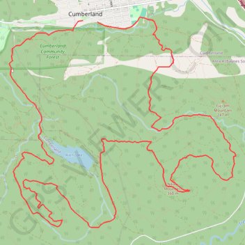
Name: The Cumby Race Course trail, distance, elevation, map, profile, GPS track
Coordinates: 49.58784 -125.04874 49.61802 -124.99883
Other hiking, mountain biking, running and outdoor activity trails
Click on a trail to view its statistics, map and profile.