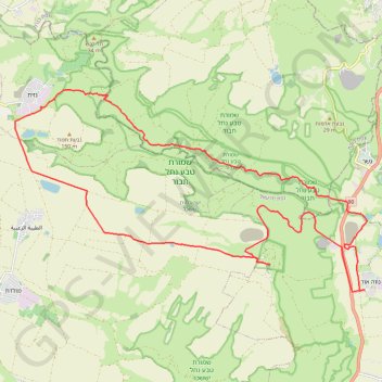
נווה אור - כוכב הירדן - נחל תבור
- Distance: 34.8 Km
- Elevation gain: 692 m
- Maximum elevation: 291 m
- Elevation loss: 691 m
- Minimum elevation: -242 m
Interactive trail map
Trail profile
- Distance: 34.8 Km
- Elevation gain: 692 m
- Maximum elevation: 291 m
- Elevation loss: 691 m
- Minimum elevation: -242 m
About this trail
Name: נווה אור - כוכב הירדן - נחל תבור trail, distance, elevation, map, profile, GPS track
Coordinates: 32.58594 35.44117 32.63952 35.55230