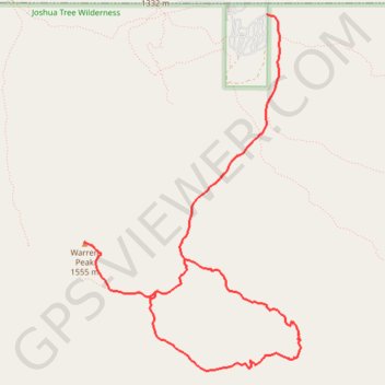
Warren Peak and Panorama Loop Trail
Interactive trail map
Trail profile
- Distance: 12.6 Km
- Elevation gain: 512 m
- Maximum elevation: 1,571 m
- Elevation loss: 512 m
- Minimum elevation: 1,209 m
About this trail
Name: Warren Peak and Panorama Loop Trail trail, distance, elevation, map, profile, GPS track
End: Black Road Campground Road, San Bernardino County, California, United States (34.07515 -116.38797)
Coordinates: 34.04401 -116.40718 34.07515 -116.38435
Other hiking, mountain biking, running and outdoor activity trails
Click on a trail to view its statistics, map and profile.