Rock Circuit Loop Trail via Boojum Rock, Ziggy's Rock, Pinnacle Rock, Black Rock and Melrose Rock in Middlesex Fells Reservation
The Rock Circuit Loop Trail is a captivating route that showcases a variety of unique rock formations and stunning vistas. Hikers will experience the impressive sights from Boojum Rock and Melrose Rock, where expansive views of Boston and the surrounding area can be enjoyed. The trail combines challenging rocky sections with tranquil wooded paths, providing a diverse hiking experience that caters to both adventure seekers and nature lovers alike. #Hiking #Loop #Rock #Overlook #Forest #Nature
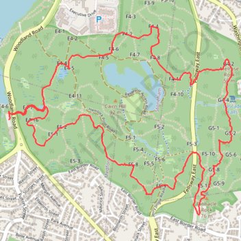
- Distance: 7.4 Km
- Elevation gain: 102 m
- Maximum elevation: 83 m
- Elevation loss: 103 m
- Minimum elevation: 39 m
- Moving time: 2 h 9 m
- Moving speed: 3.4 Km/h
- Maximum speed: 9.5 Km/h
- Total time: 2 h 23 m
- Global speed: 3.1 Km/h
Interactive trail map
Trail profile
- Distance: 7.4 Km
- Elevation gain: 102 m
- Maximum elevation: 83 m
- Elevation loss: 103 m
- Minimum elevation: 39 m
- Moving time: 2 h 9 m
- Moving speed: 3.4 Km/h
- Maximum speed: 9.5 Km/h
- Total time: 2 h 23 m
- Global speed: 3.1 Km/h
About this trail
Name: Rock Circuit Loop Trail via Boojum Rock, Ziggy's Rock, Pinnacle Rock, Black Rock and Melrose Rock in Middlesex Fells Reservation trail, distance, elevation, map, profile, GPS track
Start: Woodland Road, Medford, Middlesex County, Massachusetts, 02155, United States (42.44439 -71.09471)
End: Woodland Road, Medford, Middlesex County, Massachusetts, 02155, United States (42.44403 -71.09492)
Coordinates: 42.43808 -71.09492 42.44988 -71.07602
Other hiking, mountain biking, running and outdoor activity trails
Click on a trail to view its statistics, map and profile.
Nahant and Northern Strand Trail
United States > Massachusetts > Suffolk County > Boston
Distance: 70.3 Km • Elevation gain: 388 m • Maximum elevation: 23 m