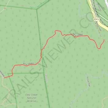
Pina Colada Trail
- Distance: 0.8 Km
- Elevation gain: 0 m
- Maximum elevation: 278 m
- Elevation loss: 151 m
- Minimum elevation: 127 m
- Moving time: 5 m 41 s
- Moving speed: 8.7 Km/h
- Maximum speed: 22.2 Km/h
- Total time: 7 m
- Global speed: 7.1 Km/h
Interactive trail map
Trail profile
- Distance: 0.8 Km
- Elevation gain: 0 m
- Maximum elevation: 278 m
- Elevation loss: 151 m
- Minimum elevation: 127 m
- Moving time: 5 m 41 s
- Moving speed: 8.7 Km/h
- Maximum speed: 22.2 Km/h
- Total time: 7 m
- Global speed: 7.1 Km/h
About this trail
Name: Pina Colada Trail trail, distance, elevation, map, profile, GPS track
End: Rincon Trail, Santa Cruz, Santa Cruz County, California, 95064, United States (37.00778 -122.04866)
Coordinates: 37.00594 -122.05463 37.00821 -122.04866