Make a donation
Gear up for your next adventure:
As an Amazon Associate, this site earns from qualifying purchases at no extra cost to you.
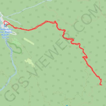
JASTREBAC, MEČJE STENE
- Distance: 10.4 Km
- Elevation gain: 609 m
- Maximum elevation: 1,003 m
- Elevation loss: 611 m
- Minimum elevation: 517 m
- Moving time: 2 h 29 m
- Moving speed: 4.2 Km/h
- Maximum speed: 9.6 Km/h
- Total time: 3 h 48 m
- Global speed: 2.7 Km/h
Interactive trail map
Make a donation
Gear up for your next adventure:
As an Amazon Associate, this site earns from qualifying purchases at no extra cost to you.
Trail profile
- Distance: 10.4 Km
- Elevation gain: 609 m
- Maximum elevation: 1,003 m
- Elevation loss: 611 m
- Minimum elevation: 517 m
- Moving time: 2 h 29 m
- Moving speed: 4.2 Km/h
- Maximum speed: 9.6 Km/h
- Total time: 3 h 48 m
- Global speed: 2.7 Km/h
Make a donation
Gear up for your next adventure:
As an Amazon Associate, this site earns from qualifying purchases at no extra cost to you.
About this trail
Name: JASTREBAC, MEČJE STENE trail, distance, elevation, map, profile, GPS track
Coordinates: 43.41151 21.37414 43.42867 21.41019
Make a donation
Gear up for your next adventure:
As an Amazon Associate, this site earns from qualifying purchases at no extra cost to you.
Other hiking, mountain biking, running and outdoor activity trails
Click on a trail to view its statistics, map and profile.
Jastrebac: Planinarski dom - Sokolov kamen - Bela stena - Ži...
Serbia > Central Serbia > Rasina Administrative District > Buci
Distance: 13.3 Km • Elevation gain: 870 m • Maximum elevation: 1,237 m
2022_Yu
Slovenia > Ajdovščina > Žapuže
Distance: 2,457.3 Km • Elevation gain: 32,048 m • Maximum elevation: 1,950 m