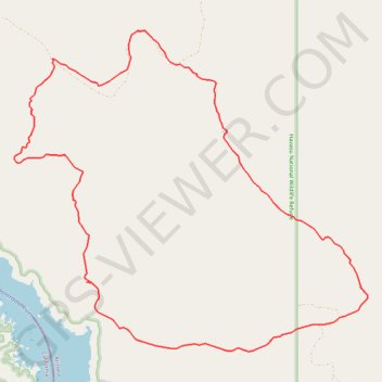
Alien Loop
Loop hike through the Havasu National Wildlife Refuge via the Alien Loop Trail by the Havasu Lake and the Colorado River. #Hiking #Loop #Nature #Rock #Desert #Moutain #Wilderness #Lake #River
- Distance: 16.6 Km
- Elevation gain: 329 m
- Maximum elevation: 358 m
- Elevation loss: 329 m
- Minimum elevation: 144 m
- Moving time: 4 h 26 m
- Moving speed: 3.7 Km/h
- Maximum speed: 5.3 Km/h
- Total time: 4 h 26 m
- Global speed: 3.7 Km/h
Interactive trail map
Trail profile
- Distance: 16.6 Km
- Elevation gain: 329 m
- Maximum elevation: 358 m
- Elevation loss: 329 m
- Minimum elevation: 144 m
- Moving time: 4 h 26 m
- Moving speed: 3.7 Km/h
- Maximum speed: 5.3 Km/h
- Total time: 4 h 26 m
- Global speed: 3.7 Km/h
About this trail
Name: Alien Loop trail, distance, elevation, map, profile, GPS track
Start: Mohave County, Arizona, United States (34.61488 -114.37612)
End: Mohave County, Arizona, United States (34.61491 -114.37611)
Coordinates: 34.60841 -114.42903 34.64800 -114.37609