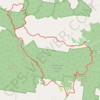
Bellthorpe - Stoney Creek
Bellthorpe National Park. #MTB #Loop #Bellthorpe
- Distance: 40.8 Km
- Elevation gain: 1,285 m
- Maximum elevation: 664 m
- Elevation loss: 1,286 m
- Minimum elevation: 136 m
Interactive trail map
Trail profile
- Distance: 40.8 Km
- Elevation gain: 1,285 m
- Maximum elevation: 664 m
- Elevation loss: 1,286 m
- Minimum elevation: 136 m
About this trail
Name: Bellthorpe - Stoney Creek trail, distance, elevation, map, profile, GPS track
Coordinates: -26.90044 152.65831 -26.81147 152.75065
Topography: Queensland topographic map, elevation, terrain
Other hiking, mountain biking, running and outdoor activity trails
Click on a trail to view its statistics, map and profile.
Mount Kilcoy Loop
Bellthorpe National Park. Conondale National Park. #MTB #Loop #Bellthorpe #Conondale
Distance: 58.4 Km • Elevation gain: 1,487 m • Maximum elevation: 717 m