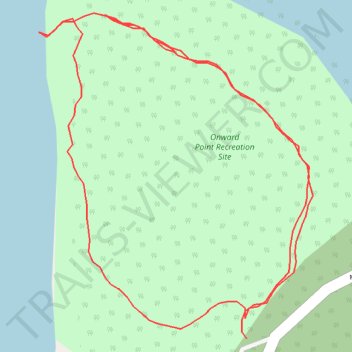
Onward Point Loop Trail
- Distance: 1.0 Km
- Elevation gain: 50 m
- Maximum elevation: 30 m
- Elevation loss: 48 m
- Minimum elevation: 0 m
- Moving time: 15 m 54 s
- Moving speed: 3.9 Km/h
- Maximum speed: 5.8 Km/h
- Total time: 23 m 54 s
- Global speed: 2.6 Km/h
Interactive trail map
Trail profile
- Distance: 1.0 Km
- Elevation gain: 50 m
- Maximum elevation: 30 m
- Elevation loss: 48 m
- Minimum elevation: 0 m
- Moving time: 15 m 54 s
- Moving speed: 3.9 Km/h
- Maximum speed: 5.8 Km/h
- Total time: 23 m 54 s
- Global speed: 2.6 Km/h
About this trail
Name: Onward Point Loop Trail trail, distance, elevation, map, profile, GPS track
Coordinates: 53.23799 -131.92199 53.23990 -131.91930