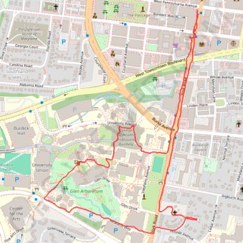
Towson Walk
- Distance: 3.8 Km
- Elevation gain: 59 m
- Maximum elevation: 145 m
- Elevation loss: 60 m
- Minimum elevation: 122 m
- Moving time: 58 m 7 s
- Moving speed: 3.9 Km/h
- Maximum speed: 6.8 Km/h
- Total time: 1 h 4 m
- Global speed: 3.5 Km/h
Interactive trail map
Trail profile
- Distance: 3.8 Km
- Elevation gain: 59 m
- Maximum elevation: 145 m
- Elevation loss: 60 m
- Minimum elevation: 122 m
- Moving time: 58 m 7 s
- Moving speed: 3.9 Km/h
- Maximum speed: 6.8 Km/h
- Total time: 1 h 4 m
- Global speed: 3.5 Km/h
About this trail
Name: Towson Walk trail, distance, elevation, map, profile, GPS track
Coordinates: 39.39082 -76.61102 39.40038 -76.60253