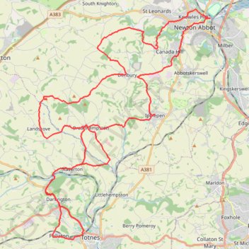
From Knowles Hill to Follaton
Ebike ride
- Distance: 55.7 Km
- Elevation gain: 1,011 m
- Maximum elevation: 123 m
- Elevation loss: 1,012 m
- Minimum elevation: 2 m
- Moving time: 2 h 58 m
- Moving speed: 18.7 Km/h
- Maximum speed: 46.0 Km/h
- Total time: 4 h 30 m
- Global speed: 12.4 Km/h
Interactive trail map
Trail profile
- Distance: 55.7 Km
- Elevation gain: 1,011 m
- Maximum elevation: 123 m
- Elevation loss: 1,012 m
- Minimum elevation: 2 m
- Moving time: 2 h 58 m
- Moving speed: 18.7 Km/h
- Maximum speed: 46.0 Km/h
- Total time: 4 h 30 m
- Global speed: 12.4 Km/h
About this trail
Name: From Knowles Hill to Follaton trail, distance, elevation, map, profile, GPS track
Coordinates: 50.43116 -3.72453 50.53782 -3.59990