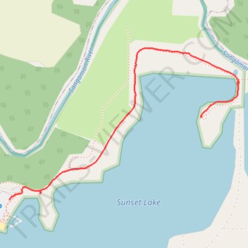
Riverbend Forest Preserve - Sunset Lake
- Distance: 1.4 Km
- Elevation gain: 6 m
- Maximum elevation: 211 m
- Elevation loss: 8 m
- Minimum elevation: 205 m
- Moving time: 24 m 38 s
- Moving speed: 3.3 Km/h
- Maximum speed: 4.9 Km/h
- Total time: 28 m 37 s
- Global speed: 2.8 Km/h
Interactive trail map
Trail profile
- Distance: 1.4 Km
- Elevation gain: 6 m
- Maximum elevation: 211 m
- Elevation loss: 8 m
- Minimum elevation: 205 m
- Moving time: 24 m 38 s
- Moving speed: 3.3 Km/h
- Maximum speed: 4.9 Km/h
- Total time: 28 m 37 s
- Global speed: 2.8 Km/h
About this trail
Name: Riverbend Forest Preserve - Sunset Lake trail, distance, elevation, map, profile, GPS track
Start: South Clapper Drive, Mahomet, Champaign County, Illinois, 61853, United States (40.18225 -88.42784)
End: Beaver Lake Court, Mahomet, Champaign County, Illinois, 61853, United States (40.18464 -88.42054)
Coordinates: 40.18225 -88.42784 40.18665 -88.41910