Killinkere
Lunch Run
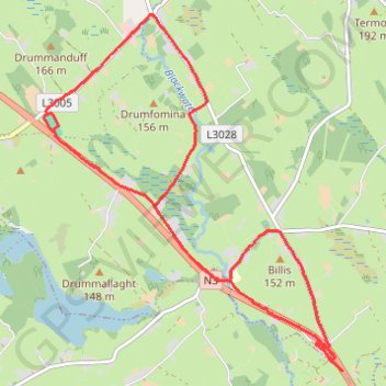
- Distance: 12.7 Km
- Elevation gain: 136 m
- Maximum elevation: 146 m
- Elevation loss: 141 m
- Minimum elevation: 99 m
- Moving time: 1 h 6 m
- Moving speed: 11.4 Km/h
- Maximum speed: 23.0 Km/h
- Total time: 1 h 6 m
- Global speed: 11.4 Km/h
Interactive trail map
Trail profile
- Distance: 12.7 Km
- Elevation gain: 136 m
- Maximum elevation: 146 m
- Elevation loss: 141 m
- Minimum elevation: 99 m
- Moving time: 1 h 6 m
- Moving speed: 11.4 Km/h
- Maximum speed: 23.0 Km/h
- Total time: 1 h 6 m
- Global speed: 11.4 Km/h
About this trail
Name: Killinkere trail, distance, elevation, map, profile, GPS track
Coordinates: 53.87827 -7.17576 53.91166 -7.12834