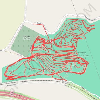
Every trail at Haunted Hills
- Distance: 36.4 Km
- Elevation gain: 848 m
- Maximum elevation: 165 m
- Elevation loss: 836 m
- Minimum elevation: 104 m
Interactive trail map
Trail profile
- Distance: 36.4 Km
- Elevation gain: 848 m
- Maximum elevation: 165 m
- Elevation loss: 836 m
- Minimum elevation: 104 m
About this trail
Name: Every trail at Haunted Hills trail, distance, elevation, map, profile, GPS track
Start: Backbone, Hernes Oak, City of Latrobe, Victoria, 3825, Australia (-38.19996 146.31650)
Coordinates: -38.20429 146.30997 -38.19771 146.32256
Topography: Victoria topographic map, elevation, terrain
Other hiking, mountain biking, running and outdoor activity trails
Click on a trail to view its statistics, map and profile.
Traralgon - Walhalla - Woods Point
Australia > Victoria > Traralgon
#Bike
Distance: 124.6 Km • Elevation gain: 4,258 m • Maximum elevation: 1,165 m