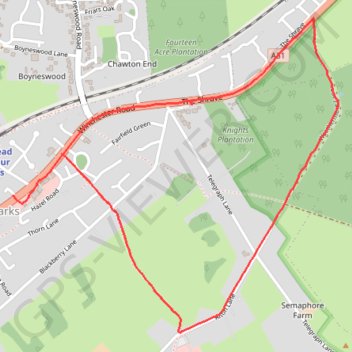
Four Marks Weathermore Lane
- Distance: 3.7 Km
- Elevation gain: 36 m
- Maximum elevation: 215 m
- Elevation loss: 45 m
- Minimum elevation: 193 m
- Moving time: 21 m 16 s
- Moving speed: 10.5 Km/h
- Maximum speed: 12.9 Km/h
- Total time: 21 m 16 s
- Global speed: 10.5 Km/h
Interactive trail map
Trail profile
- Distance: 3.7 Km
- Elevation gain: 36 m
- Maximum elevation: 215 m
- Elevation loss: 45 m
- Minimum elevation: 193 m
- Moving time: 21 m 16 s
- Moving speed: 10.5 Km/h
- Maximum speed: 12.9 Km/h
- Total time: 21 m 16 s
- Global speed: 10.5 Km/h
About this trail
Name: Four Marks Weathermore Lane trail, distance, elevation, map, profile, GPS track
Coordinates: 51.10683 -1.04456 51.11753 -1.02691