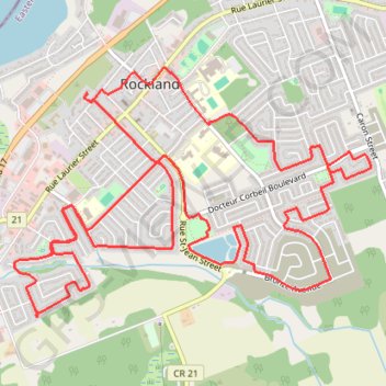
Rockland, ON CAN
- Distance: 13.8 Km
- Elevation gain: 79 m
- Maximum elevation: 72 m
- Elevation loss: 80 m
- Minimum elevation: 45 m
- Moving time: 57 m 57 s
- Moving speed: 14.3 Km/h
- Maximum speed: 26.6 Km/h
- Total time: 1 h 9 m
- Global speed: 12.0 Km/h
Interactive trail map
Trail profile
- Distance: 13.8 Km
- Elevation gain: 79 m
- Maximum elevation: 72 m
- Elevation loss: 80 m
- Minimum elevation: 45 m
- Moving time: 57 m 57 s
- Moving speed: 14.3 Km/h
- Maximum speed: 26.6 Km/h
- Total time: 1 h 9 m
- Global speed: 12.0 Km/h
About this trail
Name: Rockland, ON CAN trail, distance, elevation, map, profile, GPS track
Coordinates: 45.53346 -75.30399 45.54953 -75.27115
Other hiking, mountain biking, running and outdoor activity trails
Click on a trail to view its statistics, map and profile.
Ottawa - Grenville-sur-la-Rouge
Canada > Ontario > (Old) Ottawa
Ottawa River. #Bike #Ottawa #GrenvilleSurLaRouge
Distance: 93.5 Km • Elevation gain: 330 m • Maximum elevation: 73 m